 FAO Map Catalog
Creation year
27-1
Type of resources
Available actions
Topics
Keywords
Contact for the resource
Provided by
Years
Representation types
Update frequencies
status
Scale
From
1
-
1
/
1
-
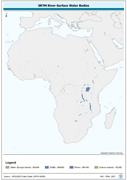
Seamless and robust derivative of SWB, Double-Lined River, and Inshore Island Features from SRTM-SWBD data tiles. The SWBD_PY shapefile data layer is comprised of 38840 derivative vector surface water bodies features derived based on 1:100 000 data originally from SRTM-SWBD. The layer provides nominal analytical/mapping at 1:125 000. Data processing 60% complete globally, with African and Arabian subsets 100% complete. Acronyms and Abbreviations: SWB or SWBD - Surface Water Body; SRTM - Shuttle Radar Topography Mission.