 FAO Map Catalog
2002
Type of resources
Available actions
Topics
Keywords
Contact for the resource
Provided by
Years
Formats
Representation types
Update frequencies
status
Scale
Resolution
-
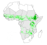
Based on bovine density (FAO, 1999), livestock systems distribution, proportion of oxen in the cattle herd structures and system-specific information on the use of bovine draught power to estimate oxen-working days per km2. Part of a study "Cattle and small ruminant production systems in sub-Saharan Africa: a systematic review" (FAO, 2002).
-

Grid with estimated maximum available soil moisture in mm/m with a spatial resolution of 5 * 5 arc minutes. Information with regard to maximum available soil moisture was calculated from the "Derived Soil Properties" of the "Digital Soil Map of the World" which contains raster information on soil moisture in different classes.
-
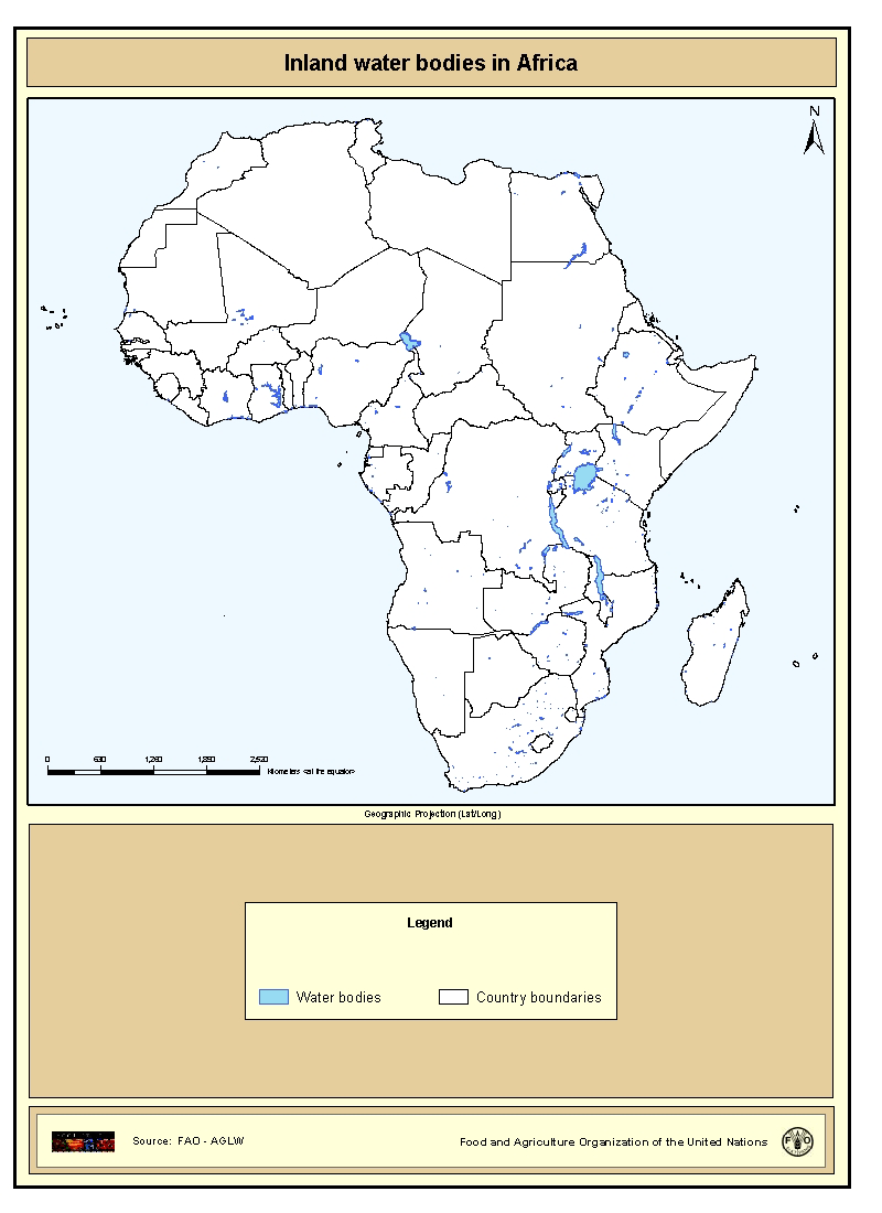
Shapefile of inland water bodies in Africa. This dataset originates from the Digital Chart of the World 1:1000000, 1998. The waterbodies for Africa have been characterized (as lake, lagoon, reservoir etc.) and named (if the names were easily available). The data layer presented contains all the waterbodies that had a name and were not characterized as river.
-

Based on bovine density (FAO, 1999), livestock systems distribution, system-specific production parameters, calculations of output per animal to obtain beef production density (output per km2) were performed using the Livestock Development Planning System Version 2 model. Part of a study "Cattle and small ruminant production systems in sub-Saharan Africa: a systematic review" (FAO, 2002).
-
Land use statistics
-

Based on bovine density (FAO, 1999), livestock systems distribution, system-specific production parameters, calculations of output per animal to obtain milk production density (output per km2) were performed using the Livestock Development Planning System Version 2 model. Part of a study "Cattle and small ruminant production systems in sub-Saharan Africa: a systematic review" (FAO, 2002).
-

Based on bovine and human population densities (FAO, 1999), livestock systems distribution, system-specific production parameters, calculations of output per animal to obtain milk offtake per capita were performed using the Livestock Development Planning System Version 2 model. Part of a study "Cattle and small ruminant production systems in sub-Saharan Africa: a systematic review" (FAO, 2002).
-
Grid with estimated easily available soil moisture in mm/m with a spatial resolution of 5 * 5 arc minutes. Information with regard to easily available soil moisture was calculated from the "Derived Soil Properties" of the "Digital Soil Map of the World" which contains raster information on soil moisture in different classes.
-

Estimated distribution of the main ruminant prodution systems based on rainfall, length of growing period, cropping pattern and mean temperature during the growing period, Part of a study "Cattle and small ruminant production systems in sub-Saharan Africa: a systematic review" (FAO, 2002).