 FAO Map Catalog
Creation year
11-0
Type of resources
Available actions
Topics
Keywords
Contact for the resource
Provided by
Years
Representation types
Update frequencies
status
Scale
From
1
-
2
/
2
-
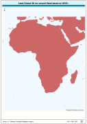
WVS+ based landmass and oceanic mask derived for processing SRTM-GTopo30 DEMs. SRTM is Shuttle Radar Topography Mission; GT30/GTopo30 is Global Topographic 30 arc second DEM database, nominal 1km postings; DEM is Digital Elevation Model. The WVS_MASK grid data layer is comprised of 10800x11400 derivative vector coastline - administrative features derived based on 1:250 000 data originally from WVS+.
-

Compilation of FAO Soil great group and major attribute characteristics with country boundaries removed. The SOILS_PY shapefile data layer is comprised of 4909 derivative vector soils features derived based on 1:5 000 000 data originally from FAO. Acronyms and Abbreviations: FAO - Food and Agriculture Organization in the United Nations.