FAO Map Catalog
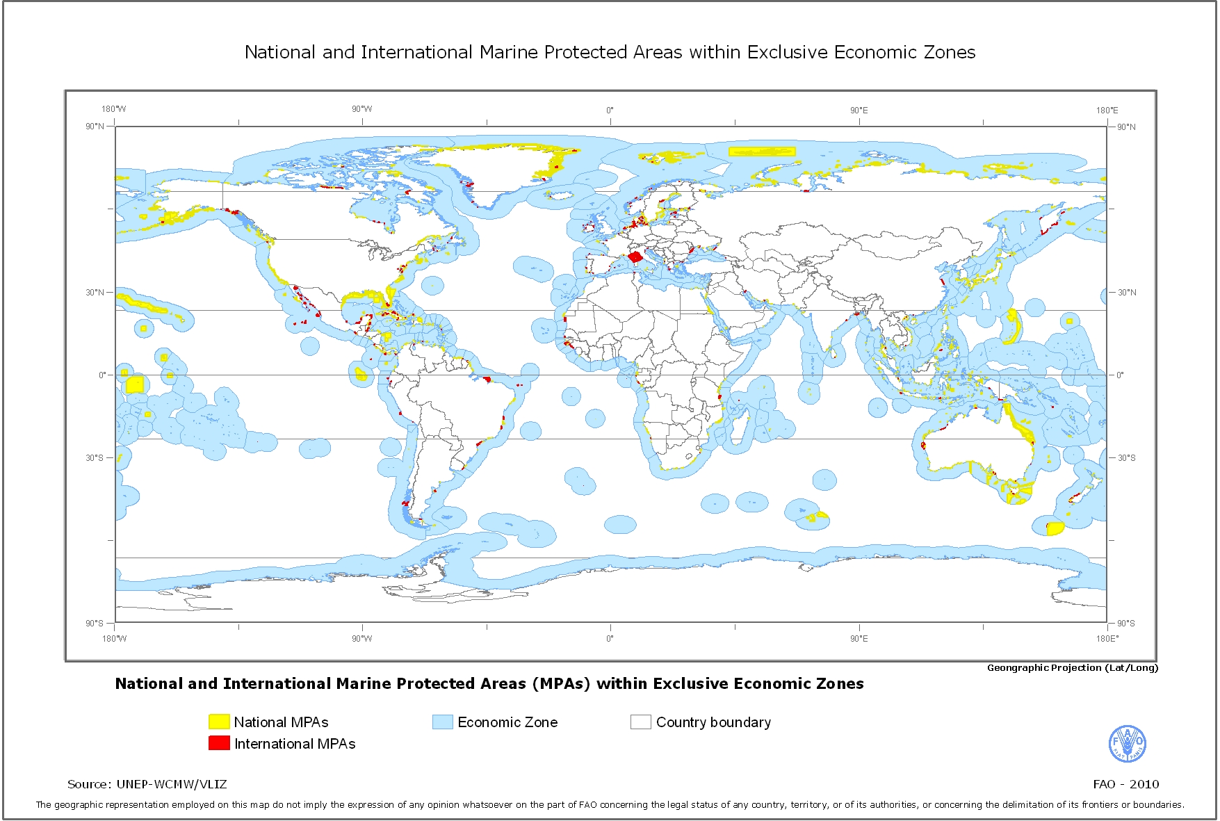
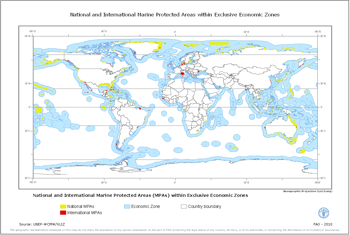
National and International Marine Protected Areas within Exclusive Economic Zones
Simple
- Date ( Publication )
- 2010-04-13T16:48:00
- Edition
- First
- Presentation form
- Digital map
- Purpose
- The dataset has been used to support a FAO offshore mariculture initiative that aims to provide spatial measures of the status and potential for off-the-coast and offshore mariculture development that are comprehensive of all maritime nations and comparable among them.
- Status
- Completed
- Maintenance and update frequency
- As needed
- Keywords ( Theme )
-
- GIS
- Mariculture
- Offshore mariculture
- Keywords ( Place )
-
- World
- Access constraints
- Copyright
- Use constraints
- Copyright
- Other constraints
- The dataset is derived from World Dataset of Protected Areas (UNEP-WCMW) and the Exclusive Economic Zones (VLIZ2009 - Flanders Marine Institute, Belgium); therefore it is subject to copyright and database right restrictions. However the reproduction of the above mentioned data sets in derivative form for scientific research, environmental conservation, education or other non-commercial purposes are authorised without prior permission, providing the source material is properly credited. Redistribution rights are granted for hard-copy renditions or static, electronic map images (e.g. jpeg, gif, etc.) that are plotted, printed or publicly displayed with reference to the sources. Redistribution rights are also granted for derived products.
- Spatial representation type
- Vector
- Metadata language
- eng
- Character set
- UTF8
- Topic category
-
- Farming
- Oceans
))
- Supplemental Information
- This dataset supports part of a review on "Spatial analysis for the sustainable development of off-the-coast and offshore aquaculture from a global perspective" to support an FAO offshore mariculture initiative. The initiative attempts to collect global information on the potential for mariculture development (off-the-coast and offshore) considering technical, biological, spatial, environmental, socio-economic, legal and policy issues and to identify major opportunities and challenges to act upon at the relevant level by FAO, its Member States and other stakeholders for the industry to expand sustainably.
- Reference system identifier
- WGS 1984
- Topology level
- Geometry only
- Geometric object type
- Complex
- Units of distribution
- Arc/GIS shapefile
- Transfer size
- 51.8
- OnLine resource
-
MPA_EEZ_GeoZones.zip
(
WWW:DOWNLOAD-1.0-http--download
)
National and International Marine Protected Areas within Exclusive Economic Zones
- OnLine resource
-
MPA.jpg
(
WWW:DOWNLOAD-1.0-http--download
)
National and International Marine Protected Areas within Exclusive Economic Zones (JPG image 824KB) )
- OnLine resource
-
geonetwork:mpa_eez_geozones_37302
(
OGC:WMS-1.1.1-http-get-map
)
National and International MPA within Exclusive Economic Zones
- Hierarchy level
- Dataset
gmd:MD_Metadata
- File identifier
- fcc3eb74-f3c9-484d-93e3-7c94e9226e2b XML
- Metadata language
- eng
- Character set
- UTF8
- Date stamp
- 2013-10-15T10:01:29
- Metadata standard name
- ISO 19115:2003/19139
- Metadata standard version
- 1.0
Overviews
Spatial extent
Provided by