 FAO Map Catalog
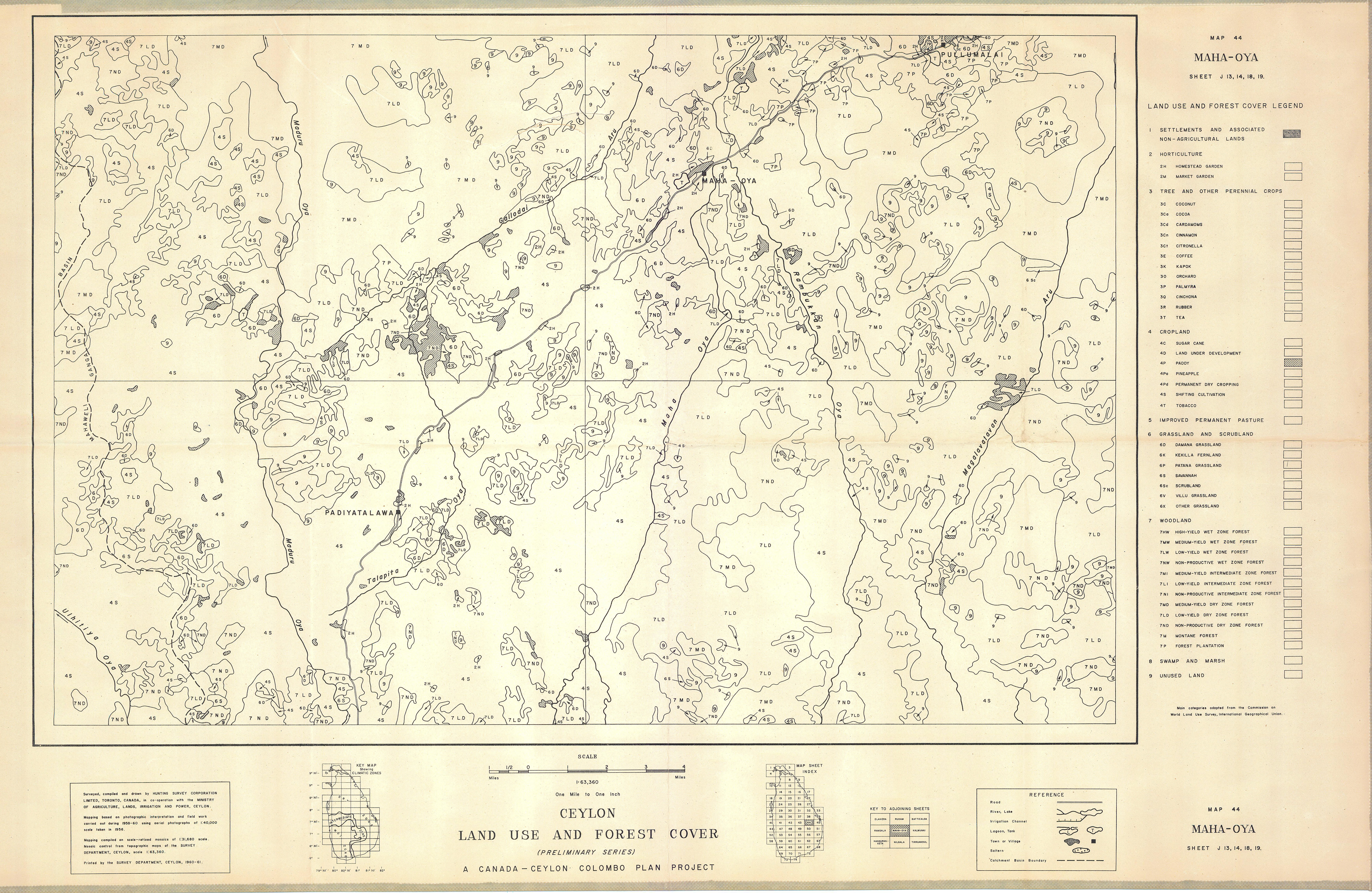
Land use and forest cover (Preliminary series) - (Maya-Oya - Sri Lanka)
Include:
Maya-Oya (Map 44)
Simple
- Date ( Publication )
- 1961-01-01
- Presentation form
- Hardcopy map
- Status
- Historical archive
Point of contact
FAO - UN AGL Documentation Center
Via delle Terme di Caracalla
,
Rome
,
00100
,
Italy
- Hours of service
- 8.30 - 17.00
- Keywords
-
- Land
- Land Use
- Keywords
-
- Land Use
- Forestry
- Crops
- Keywords ( Place )
-
- Sri Lanka
- Denominator
- 60000
- Metadata language
- eng
- Character set
- UTF8
- Topic category
-
- Economy
N
S
E
W
))
- Supplemental Information
- ISIS Identifier: 002844; Number of sheets: 74; Additional info: Canada-Ceylon Colombo Plan Project,
Distributor
- Ordering instructions
- Location of the data: FAO - AGL SRI LANKA/LAND USE
- Name
- No digital format
- Version
- n.a.
- OnLine resource
- sri_lanka-2844-land_use_and_forest_cover,maha_oya-land_use2-1-63,360.jpg ( WWW:DOWNLOAD-1.0-http--download )
- Hierarchy level
- Dataset
gmd:MD_Metadata
- File identifier
- e7f6f725-1c3e-42f1-8851-52d0e2a20c2d XML
- Metadata language
- eng
- Character set
- UTF8
- Date stamp
- 2011-12-08T20:08:14
- Metadata standard name
- ISO 19115:2003/19139
- Metadata standard version
- 1.0
Overviews
thumbnail
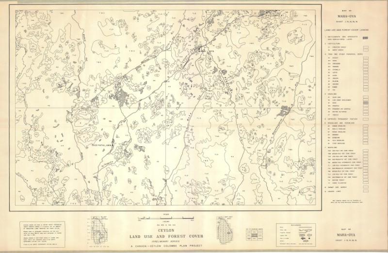
large_thumbnail
Spatial extent
N
S
E
W
Provided by

Associated resources
Not available