 FAO Map Catalog
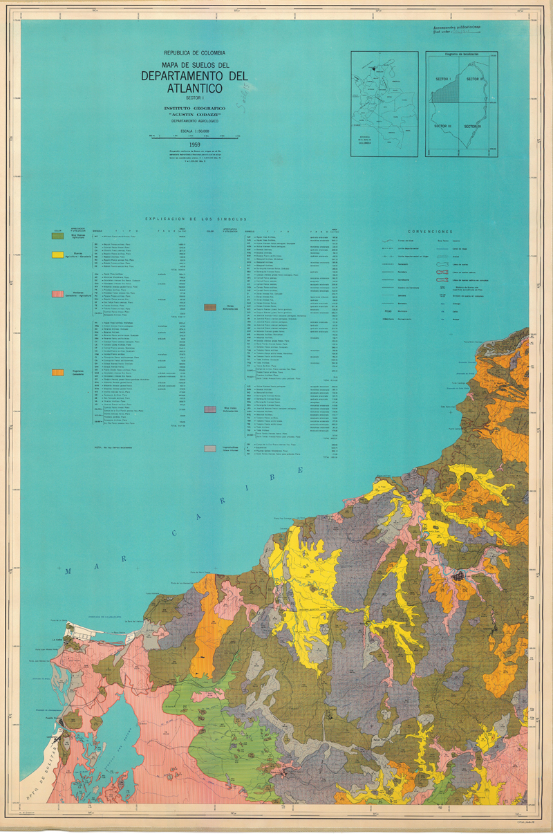
Mapa de suelos del Departamento del Atlantico (Colombia)
Mapa de suelos del Departamento del Atlantico (Sector 1, 2, 3 and 4)
Simple
- Date ( Publication )
- 1959-01-01
- Presentation form
- Hardcopy map
- Status
- Historical archive
Point of contact
FAO - UN AGL Documentation Center
Via delle Terme di Caracalla
,
Rome
,
00100
,
Italy
- Hours of service
- 8.30 - 17.00
- Keywords
-
- Soils
- Soil Classification
- Keywords
-
- Soil Types
- Keywords ( Place )
-
- Colombia
- Denominator
- 50000
- Metadata language
- spa
- Character set
- UTF8
- Topic category
-
- Geoscientific information
N
S
E
W
))
- Supplemental Information
- ISIS Identifier: 000859; Number of sheets: 4; Related document location: AGL COL/S-1
Distributor
- Ordering instructions
- Location of the data: FAO - AGL COLOMBIA/SOILS
- Name
- No digital format
- Version
- n.a.
- OnLine resource
- colombia-859-mapa_de_suelos_del_departanmento_atlantico_sector1-soils_15-1-50,000.zip ( WWW:DOWNLOAD-1.0-http--download )
- OnLine resource
- colombia-859-mapa_de_suelos_del_departanmento_atlantico_sector2-soils_15-1-50,000.zip ( WWW:DOWNLOAD-1.0-http--download )
- OnLine resource
- colombia-859-mapa_de_suelos_del_departanmento_atlantico_sector3-soils_15-1-50,000.zip ( WWW:DOWNLOAD-1.0-http--download )
- OnLine resource
- colombia-859-mapa_de_suelos_del_departanmento_atlantico_sector4-soils_15-1-50,000.zip ( WWW:DOWNLOAD-1.0-http--download )
- Hierarchy level
- Dataset
gmd:MD_Metadata
- File identifier
- cdc7ae90-88fd-11da-a88f-000d939bc5d8 XML
- Metadata language
- eng
- Character set
- UTF8
- Date stamp
- 2022-10-18T16:07:19
- Metadata standard name
- ISO 19115:2003/19139
- Metadata standard version
- 1.0
Custodian
FAO - UN AGL Documentation Center
-
Viale delle Terme di Caracalla
,
Rome
,
RM
,
00100
,
Italy
Overviews
large_thumbnail

thumbnail
Spatial extent
N
S
E
W
Provided by

Associated resources
Not available