 FAO Map Catalog
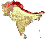
elevation
Type of resources
Available actions
Topics
Keywords
Contact for the resource
Provided by
Years
Formats
Representation types
Update frequencies
status
Scale
-

Robust derivative of VMap0 - Ed5 data layers with harmonized encoding. The HYPSO_PT shapefile data layer is comprised of 80449 derivative vector framework library features derived based on 1:1 000 000 data originally from VMap0, 5th Edition. The layer provides nominal analytical/mapping at 1:1 000 000. Data processing 75% complete globally, with African subset 100% complete. Acronyms and Abbreviations: VMap0 - Vector Map for Level 0.
-
CoastalDEM90® is a 3 arcsecond (~90 meter) horizontal resolution digital elevation model based on SRTM 3.0, a near-global dataset derived from satellite radar during a NASA mission in 2000. SRTM is known to contain significant error caused by factors such as topology, vegetation, buildings, and random noise. We have used machine learning techniques to estimate SRTM elevation error in coastal areas between (and including) 120m in nominal SRTM elevation. Each pixel in a CoastalDEM raster within the relevant elevation and spatial domains represents the corrected elevation at that point - the result of subtracting estimated error from SRTM 3.0. Pixels outside these domains are set to their original SRTM value. The Coastal DEM dataset was supplied to Worldpop under license for non-commercial use. It was modified to replace the value -32767 with those values from a SRTM-based elevation model that WorldPop have (https://hub.worldpop.org/geodata/listing?id=58) Bias (m) RMSE (m) LE90 (m) LE95 (m) USA (Original SRTM) 3.67 5.36 9.12 11.23 USA (Corrected) < 0.11 2.39 3.90 4.99 Australia (Original) 2.49 4.15 6.76 8.98 Australia (Corrected) - 0.11 2.46 3.94 5.16
-
As part of the the World Bank's review of its rural development strategy, the Bank sought the assistance of the Food and Agriculture Organization of the United Nations (FAO) in evaluating how farming systems might change and adapt over the next thirty years. Amongst other objectives, the World Bank asked FAO to provide guidance on priorities for investment in food security, poverty reduction, and economic growth, and in particular to identify promising approaches and technologies that will contribute to these goals. The results of the study are summarized in a set of seven documents, comprising six regional reports and the global overview contained in this volume. This document, which synthesises the results of the six regional analyses as well as discussing global trends, cross-cutting issues and possible implementation modalities, presents an overview of the complete study. This document is supplemented by two case study reports of development issues of importance to farming systems globally.
-
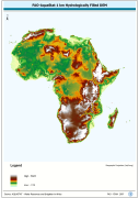
WRIA_DEM: Hydrologically filled GTopo30 DEM with the main stems of cartographic rivers "burned-in" for irrigation analysis. GT30/GTopo30 is Global Topographic 30 arc second DEM database, nominal 1km postings; DEM is Digital Elevation Model. The WRIALAEA grid data layer is comprised of 9194x8736 derivative raster hydrologically filled dem features derived based on 1 kilometer data originally from FAO.
-

As part of the the World Bank's review of its rural development strategy, the Bank sought the assistance of the Food and Agriculture Organization of the United Nations (FAO) in evaluating how farming systems might change and adapt over the next thirty years. Amongst other objectives, the World Bank asked FAO to provide guidance on priorities for investment in food security, poverty reduction, and economic growth, and in particular to identify promising approaches and technologies that will contribute to these goals. The results of the study are summarized in a set of seven documents, comprising six regional reports and the global overview contained in this volume. This document, which synthesises the results of the six regional analyses as well as discussing global trends, cross-cutting issues and possible implementation modalities, presents an overview of the complete study. This document is supplemented by two case study reports of development issues of importance to farming systems globally.
-
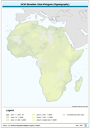
Harmonized bathymetry, coast-line and terrestrial elevation. The HYPSO_PY shapefile data layer is comprised of 21456 derivative vector physiography - hypsography features derived based on 1:1 000 000 data originally from DCW. The layer provides nominal analytical/mapping at 1:1 000 000.
-

RGB color image of nominal 3.7 Km bathymetry and terrestrial elevation values. RGB is 3 band spatial imagery forced into the Red:Green:Blue spectrum. The ETOPO2_RGB image data layer is comprised of 5400x10800 derivative raster bathymetry features derived based on 0.03333_ data originally from ETOPO2.
-
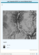
Lake Tanganyika SRTM 3 as Hillshade Mosaic. The HSHD_MOS grid data layer is comprised of 14401x16801 derivative raster hillshade features derived based on 0.000833_ data originally from SRTM. The layer provides nominal analytical/mapping at 1:250 000. Acronyms and Abbreviations: DEM - Digital Elevation Model
-
As part of the the World Bank's review of its rural development strategy, the Bank sought the assistance of the Food and Agriculture Organization of the United Nations (FAO) in evaluating how farming systems might change and adapt over the next thirty years. Amongst other objectives, the World Bank asked FAO to provide guidance on priorities for investment in food security, poverty reduction, and economic growth, and in particular to identify promising approaches and technologies that will contribute to these goals. The results of the study are summarized in a set of seven documents, comprising six regional reports and the global overview contained in this volume. This document, which synthesises the results of the six regional analyses as well as discussing global trends, cross-cutting issues and possible implementation modalities, presents an overview of the complete study. This document is supplemented by two case study reports of development issues of importance to farming systems globally.
-
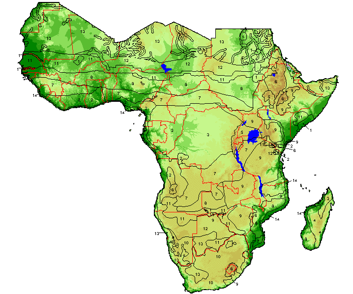
Catalog of RGB image derivaitive of SRTM 3-arc second Version 2 hillshaded DEM for Africa, seamless tiled compilation of color classified DEM and hillshade. SRTM is Shuttle Radar Topography Mission; DEM is Digital Elevation Model. The SRTM-3AS_IMGCAT_JP2 Image data layer is comprised of 3204 derivative calculated seamless image catalog features derived based on 0.000833_ data originally from FAO.