 FAO Map Catalog
Topic
biota
Type of resources
Available actions
Topics
Keywords
Contact for the resource
Provided by
Years
Formats
Representation types
Update frequencies
status
Scale
Resolution
From
1
-
10
/
178
-
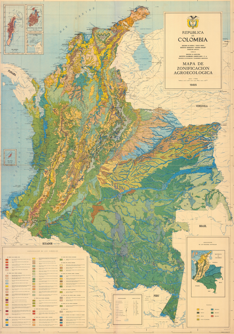
Mapa de Zonificacion Agroecologica
-

Include: Java: Blitar (1992) (33)
-

Include: Système mondial de surveillance continue de l'environnement; Vegetation Map (sheet 1 and 2)
-

Include: Ed Dair: Geology and Vegetation (Sheets 2)
-

Include: Animal density, Game and their main habitat, Main agricultural regions, Principal agricultural products, Existing hafirs constructed by Soil Conservation Section 1947-56& 1956-65
-
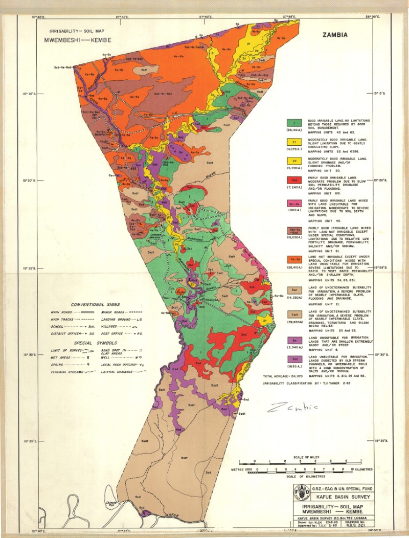
Include: Irrigability-soil map Mwembeshi-Kembe area
-

Include: Carta del rischio di desertificazione (Inset map) (200 000) - Carta pluviometrica (Tunisia) (inset map) (5 000 000)
-
Include: Carte d'utilisation des sols
-
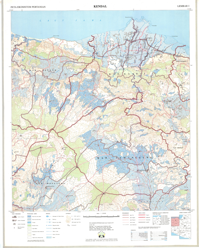
Include: Kendal (1991) (Lembar I)
-
Include: Malang (1992) (36)