 FAO Map Catalog
land cover
Type of resources
Available actions
Topics
Keywords
Contact for the resource
Provided by
Years
Formats
Representation types
Update frequencies
status
Scale
Resolution
-
Bhutan land use/land cover 2016
-
Bhutan land use/land cover 2010
-
These datasets are the main products of the National Land Use Land Cover (LULC) mapping for each epoch done by National Forestry Authority. They represent Uganda's LULC classified into 13 main classes and sub-classes according to the National Biomass Study (NBS) classification system. The NBS classification system was designed to be robust with capacity to store data on Land cover, Biomass and Wetness. Datasets available are 1990, 2000, 2005, 2010, 2015 and 2017.
-

This raster dataset provides information on land cover in Lesotho. 15 classes are considered: Urban, Cropland, Degraded Cropland, Forest Needleleaf, Forest Broadleaf, Water body, Wetland, River Bank, Shrubland, Grassland, Degraded Grassland, Bare surfaces, Mines, Irrigated Cropland, Gullies.
-
These datasets are the main products of the National Land Use Land Cover (LULC) mapping for each epoch done by National Forestry Authority. They represent Uganda's LULC classified into 13 main classes and sub-classes according to the National Biomass Study (NBS) classification system. The NBS classification system was designed to be robust with capacity to store data on Land cover, Biomass and Wetness. Datasets available are 1990, 2000, 2005, 2010, 2015 and 2017.
-
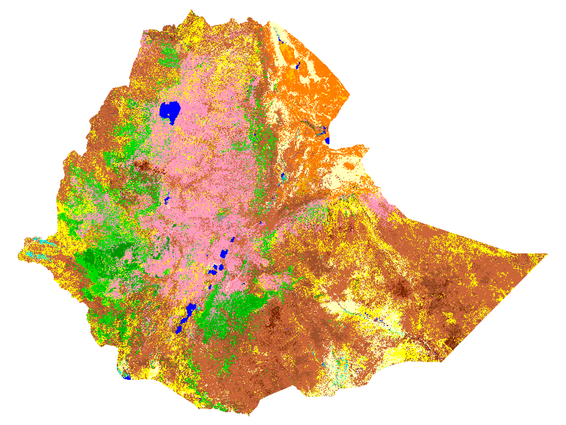
This map represents the Ethiopia Land Cover map for the development of Green House Gas Inventory. These products were derived from LandSat Imagery Data through a supervised classification method. The Ancillary data was provided by Ethiopia Mapping Agency.
-
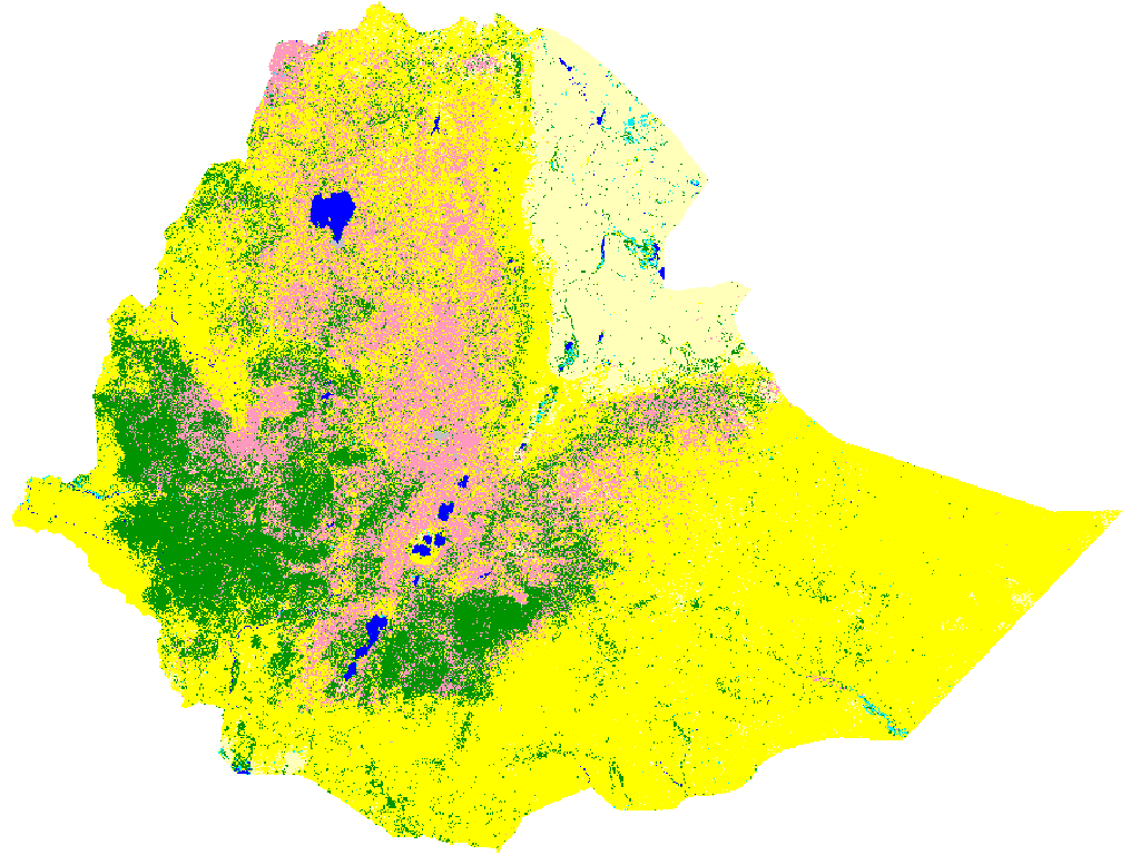
This map represents the Ethiopia Land Cover map for the development of Green House Gas Inventory. These products were derived from LandSat Imagery Data through a supervised classification method. The Ancillary data was provided by Ethiopia Mapping Agency.