 FAO Map Catalog
Somalia
Type of resources
Available actions
Topics
Keywords
Contact for the resource
Provided by
Years
Formats
Representation types
Update frequencies
status
Scale
-
The full resolution dataset of towns was developed from data from the National Imagery and Mapping Agency (NIMA).
-
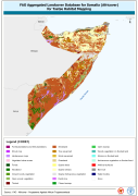
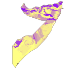
This dataset is an aggregated version of the original national Africover landcover multipurpose database. A 26-class legend is used to aggregate the classes present in the original full resolution, multipurpose landcover database. A single legend is applicable to the eight trypanosomiasis-affected countries mapped during Africover project (Burundi, Democratic Republic of the Congo, Kenya, Rwanda, Somalia, Sudan, Uganda and United Republic of Tanzania).
-

The Soil and Terrain Database Map of East Africa is a computer system for the storage, display, interpretation and analysis of the Soil Map of East Africa at scale 1:1.000.000. The system consists of the soil and terrain database with corresponding soil maps, that are accessed by the programme for visualization in different viewer formats. Various interactive querying and selection tools provide easy access to specific parts of the database for display as thematic map, data browser or data entry form.
-
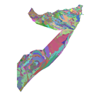
The full resolution dataset of landform and lithology has been produced from visual interpretation of digitally enhanced LANDSAT TM images acquired mainly in the period 1995-1998. The landform classes have been developed using the ITC (International Institute for Geo-Information Science and Earth Observation) and SOTER (Soil and Terrain Database) methods. The structure of the derived legend follows a specific criteria that allows an easy correlation between these classes and the standardised one listed in LCCS (SOTER classification first and second level). SOTER is a pure Parametric or Morphometric classification. The main origin or process of terrain units is an important descriptive element because it realtes to the dominant exogenous or endogenous processes. this aspect in a general classification gives a meaningful grouping and has analytical value. The proposed legend is structured in such a way that it can be read, not only from the Morphometric point of view as in SOTER, but also taking into account the main origin and the age of landforms (mainly derived from the lithology legend). Lithology is linked with the mapping units, but is listed seperately. See the full landform/lithology legend in the resource section.
-
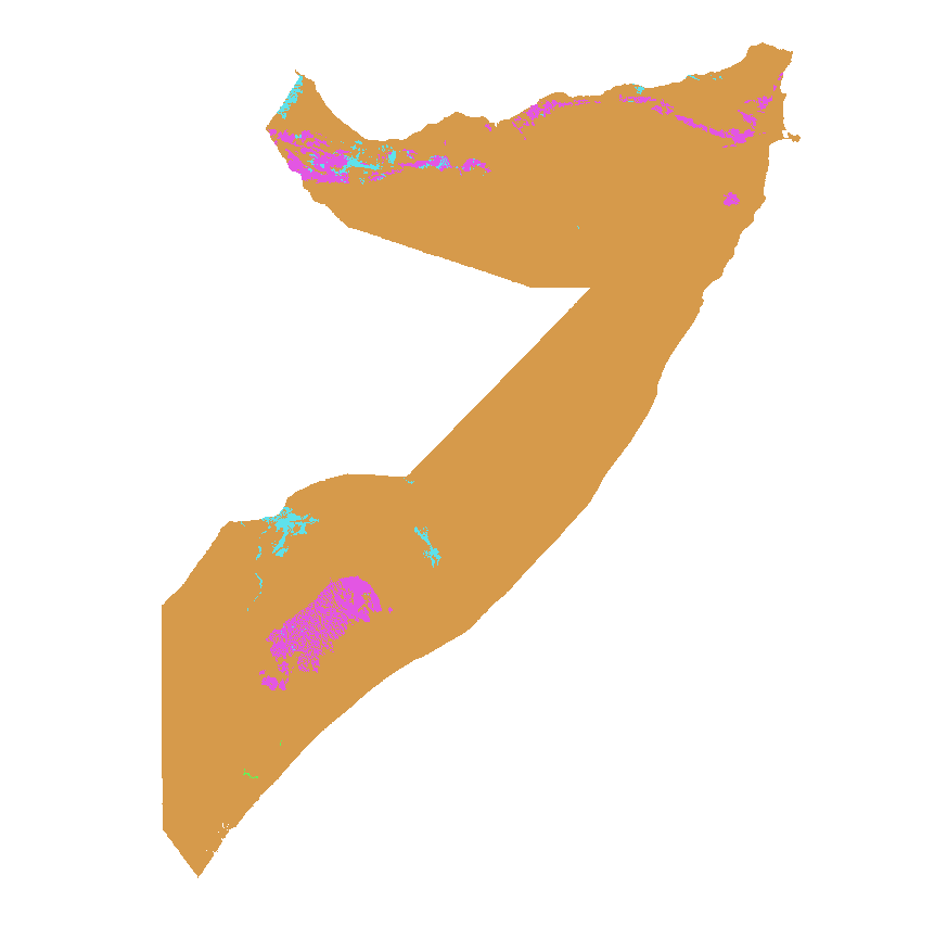
This is a thematic aggregation of the original full resolution Geomorphology/Landform and Lithology database which has been produced from visual interpretation of digitally enhanced LANDSAT TM images acquired mainly in the period 1995-1998. The landform classes have been developed using the ITC (International Institute for Geo-Information Science and Earth Observation) and SOTER (Soil and Terrain Database) methods. This thematic aggregation groups the lithology codes into three main groupins based on geological origin (i.e. Igneous, sedimentary or metamorphic). The structure of the derived legend follows a specific criteria that allows and easy correlation between these classes and the standardised one listed in LCCS (SOTER classification first and second level). SOTER is a pure Parametric or Morphometric classification. The main origin or process of terrain units is an important descriptive element because it realtes to the dominant exogenous or endogenous processes. this aspect in a general classification gives a meaningful grouping and has analytical value. The proposed legend is structured in such a way that it can be read, not only from the Morphometric point of view as in SOTER, but also taking into account the main origin and the age of landforms (mainly derived from the lithology legend). Lithology is linked with the mapping units, but is listed seperately. See the full landform/lithology legend in the resource section.
-
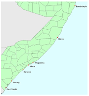
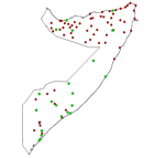
The images provide detailed rainfed crop calendar information for coastal areas in Somalia affected by the Tsunami, for the following stations: Bandarbeyla, Hobyo, Merca, Baraawe, Mogadishu, Kismayu, Buur gaado.
-
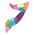
The national and administrative boundaries have been taken from the DCW dataset. Coastlines have been adapted to match the land cover dataset.
-

This is a thematic aggregation of the original full resolution Geomorphology/Landform and Lithology database which has been produced from visual interpretation of digitally enhanced LANDSAT TM images acquired mainly in the period 1995-1998. The landform classes have been developed using the ITC (International Institute for Geo-Information Science and Earth Observation) and SOTER (Soil and Terrain Database) methods. This thematic aggregation groups the landform codes into broader landform units. The structure of the derived legend follows a specific criteria that allows and easy correlation between these classes and the standardised one listed in LCCS (SOTER classification first and second level). SOTER is a pure Parametric or Morphometric classification. The main origin or process of terrain units is an important descriptive element because it relates to the dominant exogenous or endogenous processes. This aspect in a general classification gives a meaningful grouping and has analytical value. The proposed legend is structured in such a way that it can be read, not only from the Morphometric point of view as in SOTER, but also taking into account the main origin and the age of landforms (mainly derived from the lithology legend). Lithology is linked with the mapping units, but is listed separately. See the full landform/lithology legend in the resource section.
-
The Soil and Terrain Database Map of East Africa is a computer system for the storage, display, interpretation and analysis of the Soil Map of East Africa at scale 1:1.000.000. The system consists of the soil and terrain database with corresponding soil maps, that are accessed by the programme for visualization in different viewer formats. Various interactive querying and selection tools provide easy access to specific parts of the database for display as thematic map, data browser or data entry form.
-

Desert Locust Monitoring, Forecasting and Assessment in Africa and Southwest Asia. Covering Somalia. A research team RSCROP led by Prof. Huang Wenjiang and Prof. Dong Yingying of the ‘Digital Earth Science Platform’ Project in CASEarth has tracked the migration path of the Desert Locust and make a detailed analysis on the possibility of the Desert Locust invasion of China. Integrated with multi-source Earth Observation data, e.g. meteorological data, field data, and remote sensing data (such as GF series in China, MODIS and Landsat series in US, Sentinel series in EU), and self-developed models and algorithms for Desert Locust monitoring and forecasting, the research team constructed the ‘Vegetation pests and diseases monitoring and forecasting system’, which could regularly release thematical maps and reports on Desert Locust. The Desert Locust has ravaged the Horn of Africa and Southwest Asia, posing serious threats on agricultural production and food security of the inflicted regions. The Food and Agriculture Organization of the United Nations(FAO)has issued a worldwide Desert Locust warning, calling for joint efforts from multiple countries in prevention and control of the pest to ensure food security and regional stability.