 FAO Map Catalog
8-11
Type of resources
Available actions
Topics
Keywords
Contact for the resource
Provided by
Years
Representation types
Update frequencies
status
Scale
-
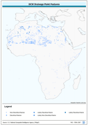
Enhanced derivative based on annotation layers of DNNET (DCW Drainage Network layer) and DNPNT sources of the DCW translated into point features. The DNPNT_PT shapefile data layer is comprised of 1635 derivative vector surface water bodies features derived based on 1:1 000 000 data originally from DCW. The layer provides nominal analytical/mapping at 1:1 000 000. Acronyms and Abbreviations: DNNET - DCW Drainage Network layer DCW - Digital Chart of the World
-

Enhanced derivative based on annotation layers of DNNET and DNPNT sources of the DCW (Digital Chart of the World) translated into point features. The DNNET_PT shapefile data layer is comprised of 4808 derivative vector surface water bodies features derived based on 1:1 000 000 data originally from DCW. The layer provides nominal analytical/mapping at 1:1 000 000. Acronyms and Abbreviations: DNNET - DCW Drainage Network layer DCW - Digital Chart of the World.
-
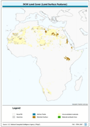
Harmonized bathymetry, coast-line and terrestrial elevation. The AF_LCSRF shapefile data layer is comprised of 7682 derivative vector physiography - hypsography features derived based on 1:1 000 000 data originally from DCW. The layer provides nominal analytical/mapping at 1:1 000 000. Acronyms and Abbreviations: DCW - Digital Chart of the World.