 FAO Map Catalog
Creation year
19-0
Type of resources
Available actions
Topics
Keywords
Contact for the resource
Provided by
Years
Representation types
Update frequencies
status
Scale
From
1
-
2
/
2
-
Seamless nominal 90 metre DEM (Digital Elevation Model) of Volta Megabasin. The VOLTA_HSHD image data layer is comprised of 13201x14401 derivative raster hillshade features derived based on 0.000833_ data originally from SRTM 3as v.2.
-
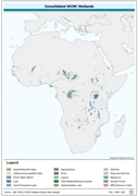
Wetlands, re-encoded from country separates of WRI-AFDS to a seamless continental derivative. The WTLND_PY shapefile data layer is comprised of 4404 derivative vector wetlands features derived based on 1:1 000 000 data originally from WCMC. The layer provides nominal analytical/mapping at 1:1 000 000. Acronyms and Abbreviations: WCMC - World Conservation Monitoring Centre; WRI - World Resources Institute; AFDS - African Data Sampler.