 FAO Map Catalog
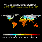
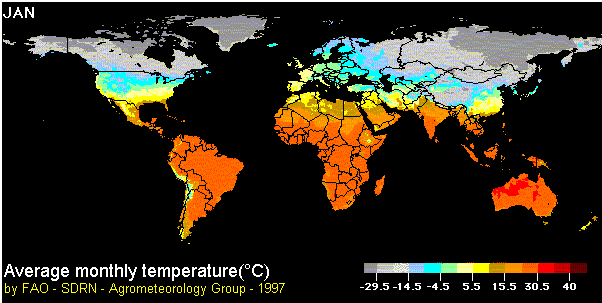
Average monthly temperature
This map is part of a series of global climate images produced by the Agrometeorology Group and based on data for mean monthly values of temperature, precipitation and cloudiness prepared in 1991 by R. Leemans and W. Cramer and published by the International Institute for Applied Systems Analysis (IIASA).
For each of the weather stations used data have been assembled over a long time period - usually between 1961 and 1990 - and then averaged.
Simple
- Date ( Publication )
- 1997
- Presentation form
- Digital image
- Status
- Completed
Point of contact
FAO-UN - Climate and Environment Division (CBC)
-
Hideki Kanamaru
(
Natural Resources Officer
)
- Maintenance and update frequency
- As needed
- Keywords ( Theme )
-
- temperature
- Tag_climate
- Keywords ( Place )
-
- World
- Keywords
-
- Agromet
- Access constraints
- Copyright
- Spatial representation type
- Vector
- Metadata language
- eng
- Character set
- UTF8
- Topic category
-
- Climatology, meteorology, atmosphere
N
S
E
W
))
- Supplemental Information
- The IIASA data correspond to an imaginary "net" covering the Earth's surface with a mesh size of 0.5 degrees. This is equivalent to about 60 km - an area of about 3,600 sq. km - at the equator. Monthly climatic data for each cell in the net are provided by weather stations and consist of an average, or "normal", value of monthly climate elements. Using spatial extrapolation, a value is computed for each cell based on the neighbouring station values. FAO's Agrometeorology Group converted the IIASA tables into grids than, using Image Display and Analysis (IDA) software, it assigned to the estimated value of each cell a colour code: for instance, yellow for monthly rainfall below 95mm, and green above.
- Reference system identifier
- WGS 1984
- Number of dimensions
- 3
- Dimension name
- Row
- Dimension name
- Column
- Dimension name
- Vertical
- Cell geometry
- Area
- Transformation parameter availability
- No
- Protocol
- WWW:LINK-1.0-http--link
- Function
- Information
- Hierarchy level
- Dataset
gmd:MD_Metadata
- File identifier
- dad00420-88fd-11da-a88f-000d939bc5d8 XML
- Metadata language
- eng
- Character set
- UTF8
- Date stamp
- 2019-11-22T10:42:14
- Metadata standard name
- ISO 19115:2003/19139
- Metadata standard version
- 1.0
Point of contact
FAO-UN - Climate and Environment Division (CBC)
-
Hideki Kanamaru
(
Natural Resources Officer
)
Viale delle Terme di Caracalla
,
Rome
,
00153
,
Italy
Overviews
thumbnail
large_thumbnail
Spatial extent
N
S
E
W
Provided by

Associated resources
Not available